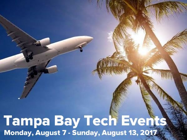
Categories
Swift Kick

My “How to constrain text fields” and “How to work with dates and times in Swift” articles, updated for Swift 2

xcode

Of all the new features that come with the upcoming “2.0” version of Apple’s Swift programming language, there’s an annoying one: it breaks a lot of earlier code. I’ve been going through my more popular Swift articles and updating them for Swift 2, and now they’re ready:

How to program an iOS text field that takes only numeric input or specific characters with a maximum length: One of the most popular tutorials on this blog, this covers a way to constraint text fields so that they accept only numeric input or specific characters, and limits the number of characters they will accept.

How to work with dates and times in Swift, part one: An introduction of Cocoa’s date and time classes, and how they work together. This article covers UTC (Coordinated Universal Time), and the key classes: NSDate, NSCalendar, NSDateComponents.

How to work with dates and times in Swift, part two: Calculations with dates: Now that we’ve got the basics, it’s time to do some date arithmetic: comparing two dates to see which one is the earlier and later one, finding out how far apart two dates are, and adding and subtracting from dates.

How to work with dates and times in Swift, part three: Making date arithmetic more Swift-like: Cocoa’s date and time classes have an Objective-C heritage, which in the Swift context, feel kind of clunky. In this article, I look at ways — and by ways, I mean helper functions and class extensions — to make date calculations feel more like Swift.

How to work with dates and times in Swift, part four: A more Swift-like way to get the time interval between two dates: This quick article shows you how to make an operator overload that makes getting the time interval between two dates more like subtraction.

Categories
Uncategorized

Xcode 7 beta 6 is now available!

beta 6 is out

If you’re the kind to keep up with the latest Xcode betas, you’ll want to go to the Xcode download page, because Apple have just released beta 6 of the upcoming Xcode 7! If you’ve been thinking about taking Swift 2 for a spin but have been holding off, you may want to try this one — we’re not far away from the GM release, and most of the changes seem to be bug fixes.

Categories
Uncategorized

40% off 128GB SanDisk microSD card – Was $100, now $60 until August 30th

sandisk microsd card sale

Here’s your deal of the day! If you’ve wanted to dramatically increase the storage on your Android device, needed to shoot a lot of video on your digital camera, or needed extra drive space on your laptop but don’t want to lug an external hard drive around, this deal’s for you. From now until the end of August 30th, Amazon has taken 40% off the $100 price tag for the older version of SanDisk’s Ultra 128GB UHS-I/Class 10 microSDXC memory card, knocking its price down to a mere $60. The card comes with an adapter so that it’ll fit into full-sized SD card slots (like those in your laptop or digital camera) as well as in microSD card slots like those in your Android smartphone or tablet.

Note that this is SanDisk’s older model of 128GB microSD card, with a maximum read speed of 48MB per second (and you can assume the write speed is slower). The newer model, which boasts a faster read speed of up to 80MB/second, normally sells for $150 and is currently listed on Amazon for $110.

Categories
Uncategorized

[Updated] “Dark Mobile” webinar with Enterprise Mobile: September 29th

dark mobile

On Tuesday, September 29th at 1:00 p.m. eastern (10:00 a.m. Pacific), GSG and Enterprise Mobile will host a webinar titled The Secrets Nobody Tells You About Dark Mobile. It’s free to attend, and you can register here.

In this webinar, Enterprise Mobile’s VP Sales Jay Gordon and GSG’s Platform Evangelist Joey deVilla will talk about that area of an organization’s mobile telecom environment that goes, unobserved, unknown, or unmanaged — the terra incognita that we call “Dark Mobile”. We look at the negative effects it has on a company’s…

  • spending,
  • management,
  • security, and
  • efficiency

Join us in this quick webinar (it’ll be about half an hour) as we look at the four kinds of Dark Mobile and how we can shed some light into this crucial area of your IT environment.

this article also appears in the GSG blog

Categories
Uncategorized

Alphabet explained

This chart is the quickest way to explain the companies under Larry Page and Sergei Brin’s new holding company, Alphabet:

alphabet explained

Click the graphic to see it at full size.

Categories
Uncategorized

Alphabet: Because “Umbrella Corporation” was already taken

umbrella corporation

I’ll bet their original motto was also “Don’t be evil”.

Larry Page has just announced that he’s creating a new holding company called Alphabet. In the latest post on Google’s official blog, he writes:

What is Alphabet? Alphabet is mostly a collection of companies. The largest of which, of course, is Google. This newer Google is a bit slimmed down, with the companies that are pretty far afield of our main Internet products contained in Alphabet instead. What do we mean by far afield? Good examples are our health efforts: Life Sciences (that works on the glucose-sensing contact lens), and Calico (focused on longevity). Fundamentally, we believe this allows us more management scale, as we can run things independently that aren’t very related. Alphabet is about businesses prospering through strong leaders and independence. In general, our model is to have a strong CEO who runs each business, with Sergey and me in service to them as needed. We will rigorously handle capital allocation and work to make sure each business is executing well. We’ll also make sure we have a great CEO for each business, and we’ll determine their compensation. In addition, with this new structure we plan to implement segment reporting for our Q4 results, where Google financials will be provided separately than those for the rest of Alphabet businesses as a whole.

Alphabet’s site is located at the clever URL abc.xyz:

alphabet web site

…which makes it the second .xyz domain I know. Here’s the first:

hooli xyz site

Categories
Hardware Mobile

How GPS works, and how to make the most of it

smartphone gps and map

One of the most common uses for smartphones is finding out where you are. According to a Pew report from September 2013, nearly three-quarters of adult smartphone users use their smartphones to get directions or other information based on their location.

At the heart of this functionality is GPS, the Global Positioning System, which is built into every smartphone and those tablets that are equipped to access cellular networks. Chances are that you’ve make some use of it, and we thought you might want to know how it works. In this article, we’ll explain GPS in layperson-friendly terms, and also give you some practical and not-so-practical tips on how to get the most out of it.

GPS constellations

The earth is surrounded by GPS satellites organized into a constellation. The basic design of the GPS system calls for a constellation divided into 6 different orbital planes, with 4 satellites per orbital plane, for a total of 24 satellites arranged the pattern shown below:

gpsorbits

This arrangement ensures that no matter where you are on the planet, there will be at least four satellites in the sky above you.

We rely on the GPS system so much that there are more than 24 satellites in orbit; the additional ones provide additional accuracy and can be used as backup in case some satellites fail. At the time of this writing, there are 32 satellites in the GPS constellation, 31 of which are usable. You can find out how many GPS satellites are in the constellation at the moment by visiting the United States Naval Observatory’s Current GPS Constellation page and the constellation’s status with the Daily GPS Constellation Status page.

The GPS system is based on time and math you learned in grade school

The GPS system relies on time to measure distances. GPS satellites have onboard atomic clocks, which are the most accurate known time-keeping devices. Atomic clocks use the radiation emissions of a cesium isotope as a “pendulum” that “swings” about 9.2 billion times a second, providing nanosecond (billionth of a second, or 10-9 seconds) accuracy. A nanosecond happens so quickly that during its span, even light can’t get very far: just a little over 9 feet (a little under 3 meters).

With such a precise clock, you can use radio transmissions to measure distances using the grade school math formula distance = speed × time:

gps 01

With the distances between itself and a small number of GPS satellites, your smartphone can quickly figure out your location.

How your smartphone uses its distance from GPS satellites to figure out your location

We’re going to keep the explanations simple, and won’t bog you down with a lot of math. We’ll do this by treating space as having only two dimensions rather than three.

If you know the distance between yourself and a single satellite — let’s call it x — you know that you’re somewhere on a circle of radius x with the satellite in the middle. That narrows down your possible location somewhat, but it’s not enough to figure out where you are:

gps 02

If you add another satellite to the mix and can get the distance between you and it — let’s call that distance y — you know that you’re also somewhere on a circle with a radius of y with that second satellite in the middle. Since you’re also on the circle of radius x, you must therefore be in one of the two places where both circles intersect. That narrows down the possibilities for your location considerably:

gps 03

With a third satellite, you can perform trilateration, which narrows down your location to a single spot:

gps 04

In case you were wondering, trilateration finds a location through the use of three distances. The term you’re probably more familiar with, triangulation, finds a location through the use of three angles.

Often, a fourth satellite is involved, and it serves two purposes:

  • It’s needed to act as a reference for when the GPS signal arrived at your smartphone. Remember, in order to determine the distance between your smartphone and a satellite, you need to know the precise time when the signal arrived at your smartphone. Unfortunately, the clock on your smartphone isn’t anywhere as accurate as an atomic clock, so the GPS receiver in your smartphone uses the time broadcast from a fourth satellite as a reference clock to determine when the signals from the other three reached it.
  • It increases location accuracy. Remember, in the diagrams above, we treated the earth as two-dimensional — that is, a flat surface — and required three distances to determine our location. In real three-dimensional space, we need four distances, which requires four satellites. However, with a little mathematical trickery that we won’t get into here, a GPS can get an approximate position with only three satellites.

Practical considerations

GPS alone doesn’t cost anything (unless you’re a U.S. taxpayer)

oh yes its freeYou may have noticed the cellular and internet networking aren’t mentioned in our explanation of how GPS works. Plain old GPS relies solely on the continuous, one-way signals broadcast by satellites and doesn’t need any cellular or internet data. Your smartphone doesn’t even send a request to a satellite to find its location, but simply listens to GPS’ always-on, always-available signals, in the same way you’d look for street signs and landmarks to get your bearings. As a result, using GPS by itself on your smartphone doesn’t eat into your data allotment or cost you any money…unless you’re a U.S. taxpayer.

The GPS system was developed by the United States Air Force, who’ve maintained it for the past 20 years and provide it for free to everyone worldwide. If you pay taxes in the U.S., you’re footing the bill for GPS, and lost people everywhere thank you.

Maps use your data plan unless you use offline maps

mapsThe location data that you get from GPS — your latitude and longitude — are meaningless by themselves to most people. Usually, this data is paired with contextual information, such as a map from Google Maps, or a database of nearby locations from apps like Yelp, Starbucks, or GasBuddy. This contextual information comes from the internet, and if you’re getting it through your cellular connection rather than wifi, it’s using your allotted data, and you’re paying for it.

If you use your smartphone as your navigation system and you’re driving long distances, your smartphone will download new map data as needed. If you’re on a limited plan, watch for this — this could be a big consumer of data.

If you use GPS often and are worried that your map use is eating into your data allotment, or if you’re using GPS while roaming, you should consider using offline maps. These are maps that are stored on your device, which means that it doesn’t have to use the internet to get them. As a result, you’re only using GPS to navigate, and not using any cellular data. Here are a couple of offline map options:

  • The Google Maps app (free, available on the iOS App Store and Google Play) allows you to download and save maps for areas as large as 31 miles by 31 miles (50 km by 50 km). Here are the iOS instructions, and here are the Android instructions.
  • MAPS.ME (free for the “lite” version) runs on iOS, Android, and BlackBerry. There’s a “lite” version that provides the basics for getting around, and a paid “pro” version that lets you search and bookmark locations.
  • Galileo (free, available on the iOS App Store) is a good choice for iPhone and iPad users looking for a free offline map app.
  • If you want a more full-featured map app, you should consider looking at paid apps. Wired recently reviewed a few of them: Sygic, Navmii, CoPilot, and Navigon.

GPS works better with cellular and wifi networking turned on

skyscrapers and trees from the ground

Since GPS uses radio waves from satellites to measure distances, it works best when the straight-line path between your device and the satellite isn’t impeded. Getting clear line-of-sight to the satellites above isn’t always possible in urban or tree-lined areas, and it’s impossible when you’re indoors. Luckily, there’s WPS (Wifi Positioning System), which is used to augment GPS by making use of the known locations of wifi base stations.

WPS works by using one or more databases containing the locations of wifi base stations based on their “fingerprints”, which are based on their SSIDs (their “names”) and MAC addresses (the unique identifier attached to every networked device) and their signal strength. These databases contain information on up to hundreds of millions of wifi base stations gathered from various sources. Quite often, these sources are everyone’s smartphones, which continually scan for wifi base stations and transmit their “fingerprints” and locations back to Apple, Google, or Microsoft, depending on your phone’s operating system. The keepers of these databases assure us that they’re protecting our privacy by anonymizing the data (take this statement with an appropriately-sized grain of salt).

There’s also aGPS — assisted GPS — which uses cellular networking to help your smartphone get the necessary information to more quickly acquire the satellite signals.

If you turn on cellular and wifi networking  on your phone, it works in combination with GPS to provide you more accurate location information in more places, even in places where satellite signals aren’t as accessible. Wifi-only devices, such iPads without cellular data capability, use WPS to determine their location.

GPS is a power hog

usb car adapterListening for an extended time to a handful of radio signals from satellites in space transmitting at a very slow rate — 50 bits (three characters on a web page) per second — eats battery power. Since your smartphone has to listen for these signals for extended periods, using GPS causes it to override its very clever and aggressive power-management system, which normally keeps power consumption to a minimum. Mapping applications, which are often used in conjunction with GPS, are processor-intensive, which increases the power drain.

When you’re using GPS on your phone while unplugged, use it sparingly. If you’re using GPS on your phone on a long drive, plug it in. You should keep a spare USB charging cable in your car, and if it doesn’t have a USB charging port, you should also keep a cigarette lighter USB power adapter (pictured above and to the right) handy.

Not-so-practical (but fun) considerations

On newer smartphones and operating systems, GPS stays on even in airplane mode

airplane modeIf you’re using iOS 8.3 or later (you can check by going to Settings → General → About and then look for Version) or a number of newer Android phones (including Samsung Galaxy S4 or later), the GPS remains on even in “Airplane Mode”.

This is probably due to the fact that GPS is a receive-only technology; it doesn’t send out signals and therefore is less likely to interfere with the airplane’s electronics and navigation systems. Now that a number of flights have wifi, it’s now possible to see a map showing your current location in mid-flight. If you zoom in closely enough, you can see how quickly you’re zipping over city streets, which is an oddly mesmerizing experience.

GPS, Interstellar, and Einstein can turn you into a science genius

And finally, here’s an interesting fact concerning GPS that will give you some serious science cred at your social gathering. Let’s take a little detour by way of this scene from the 2014 film Interstellar:

interstellar - millers planet

In the scene pictured above, a team of astronauts led by Matthew McConaughey lands on a water-covered planet orbiting giant black hole. The black hole’s gravity is so strong that it slows down time in its general vicinity: for every hour they spend on the planet, seven years pass for outside observers.

The idea of gravity slowing down time wasn’t something dreamed up by the film’s authors. Instead, it was dreamed up by Albert Einstein, when he came up with the Theory of Relativity. We’ll simply summarize Einstein’s greatest work with these two practical consequences:

gps 05

While the effects of gravity on the GPS system aren’t anywhere as dramatic as in Interstellar, they’re still important enough to be accounted for.

GPS satellites orbit the earth at an altitude of 12,500 miles (20,000 km), which means that the force of gravity on them is much lower. While in orbit, they move at 8,700 mph (14,000 km/h). Both these factors have measurable effects on time:

gps 06a

Since the GPS system relies on precise timekeeping, it introduces a time correction to account for the different speeds at which time moves on earth and on the satellites. The fact that this correction is needed is a practical, everyday application of Einstein’s Theory of Relativity and the seemingly sci-fi concept of warping time.

this article also appears in the GSG blog